Route 66 / U.S. Highway 66 in Historical Context
U.S. 66 was not just a road. It was an institution. It was a powerful agent of social and economic change. It offers a window into forces at work in the creation of the modern world we sometimes take as a given. The key to understanding Highway 66, as simple as it is, is often overlooked in favor of nostalgia that stops the clock at favorite, romantic moments. The key to a meaningful understanding of U.S. 66 is to remember that the highway evolved over the approximately five decades of its existence, and as it evolved so too did the businesses, communities, cultures, and environments along its path. In a delicate dance of historical change, the road brought changes, changes that were sometimes welcome and sometimes devastating to everything that touched it. Entire communities prospered and gained new identities as traffic along the road grew, as the roadway itself attracted more businesses and then the same communities often suffered, or even collapsed, when that increased traffic generated changes in the road alignment, bypassing businesses and communities that had grown to depend on it, as chains replaced the mom and pop businesses that had found opportunity along its curbs, and as interstate highways with their limited access pushed high speed transportation sometimes within sight of businesses starved for the commerce the roadway had once provided.
A starting point is a short essay on Route 66 in Oklahoma that I prepared for the Encyclopedia of Oklahoma History and Culture: http://www.okhistory.org/publications/enc/entry.php?entry=RO037
A longer study that I prepared for the Oklahoma State Historic Preservation Office to help evaluate the historical significance of buildings, sites, roads and bridges, and other features associated with Route 66 in Oklahoma can be found at:
http://www.google.com/url?sa=t&rct=j&q=&esrc=s&source=web&cd=20&ved=0CFYQFjAJOAo&url=http%3A%2F%2Fwww.okhistory.org%2Fshpo%2Fthematic%2Frt66hr26-70.pdf&ei=g8j1T_vZCemY2wXW5vjJBg&usg=AFQjCNH0b7RBbyiv9utoyK6x9TNR0146bg
After I prepared the Oklahoma study, the National Park Service selected me to conduct a study of the entire Route 66 in the United States. The result was this historic context study for U.S. Route 66. That study subsequently served as the core of the Multiple Property Document for nominating Route 66 related resources to the National Register of Historic Places. That document, of which I am co-author, can be found at: http://www.nps.gov/rt66/HistSig/NationalMPDF.pdf
And don't forget to check the National Park Service Route 66 Corridor Preservation Program at http://ncptt.nps.gov/rt66/.
U.S. Highway 66 / Route 66
in Oklahoma
In Oklahoma, as in other states where it passed through, U.S. 66 had a transformative affect, reshaping the landscape, the culture, the economy, and virtually everything it touched along the 400 some miles of its route. While I discuss these changes in my various longer studies mentioned above, I have also attempted to identify what they look like on the ground with a series of nominations of properties in Oklahoma to the National Register of Historic Places because of their demonstrable association with Highway 66. Below is a list of the specific Oklahoma Route 66 properties I nominated and saw listed on the National Register.
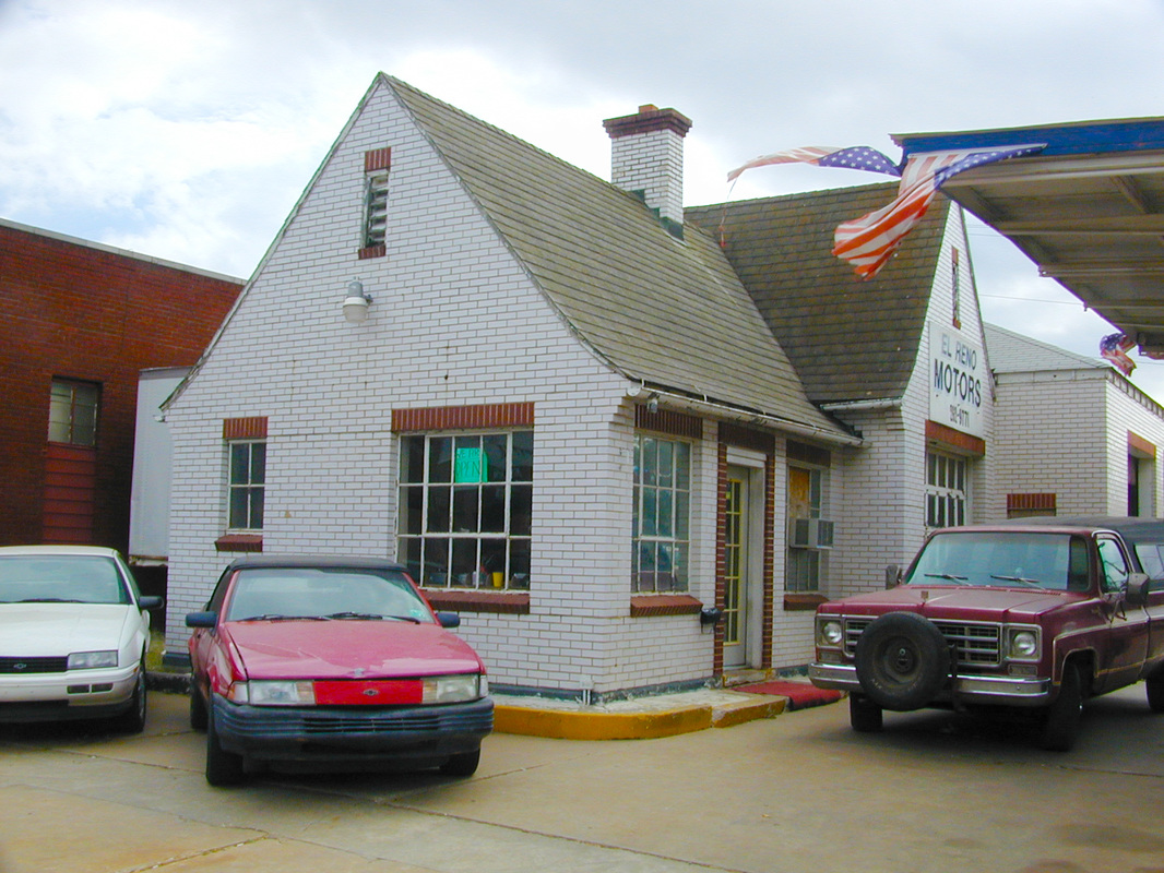
1. Avant’s Cities Service Station, El Reno (Canadian County), Oklahoma. Listed on the National Register of Historic Places March 2, 2004.
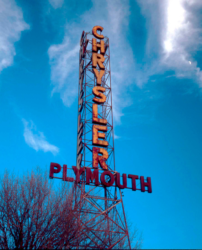
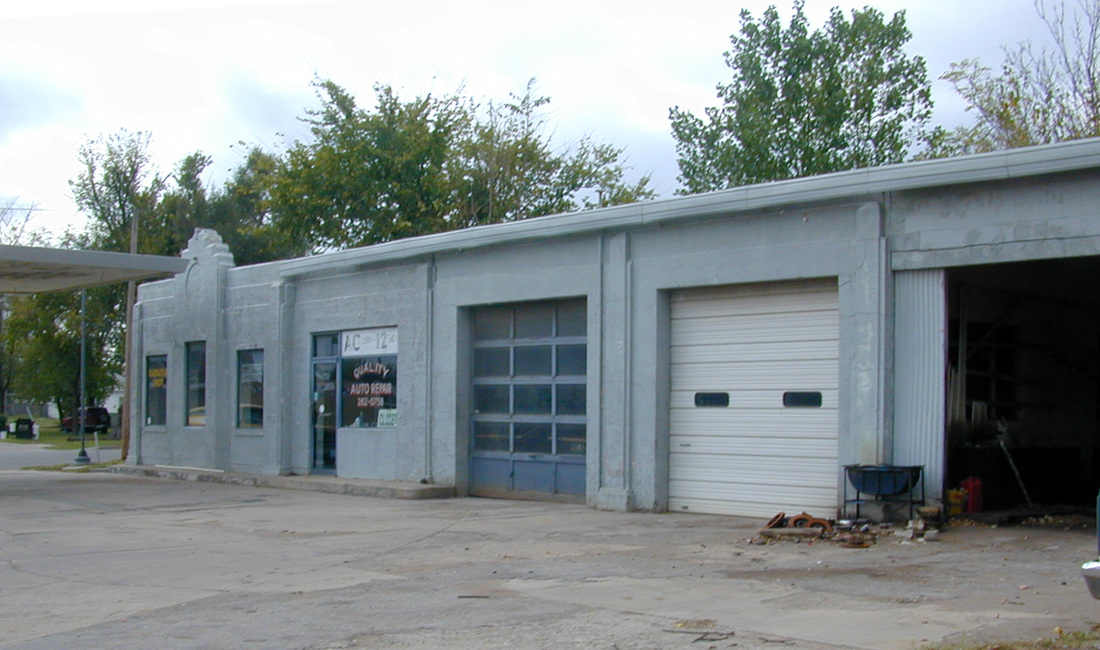
Beard Motor Company, Bristow (Creek County), Oklahoma. Listed on the National Register of Historic Places May 27, 2004.
Bridgeport Hill Service Station, vicinity Geary (Canadian County), Oklahoma. Listed on the National Register of Historic Places December 5, 2003.
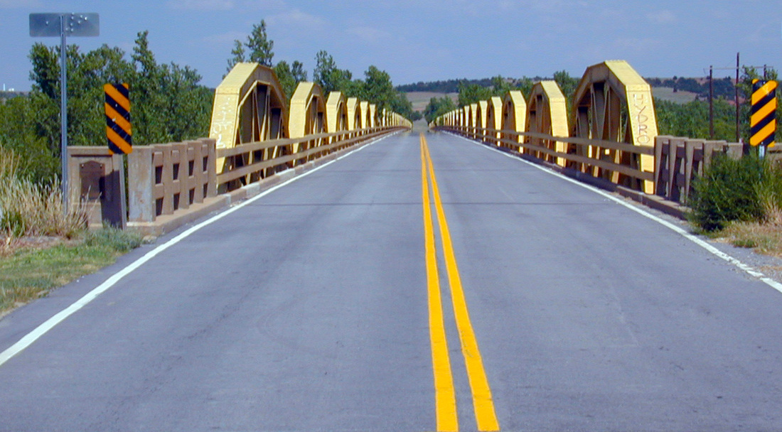
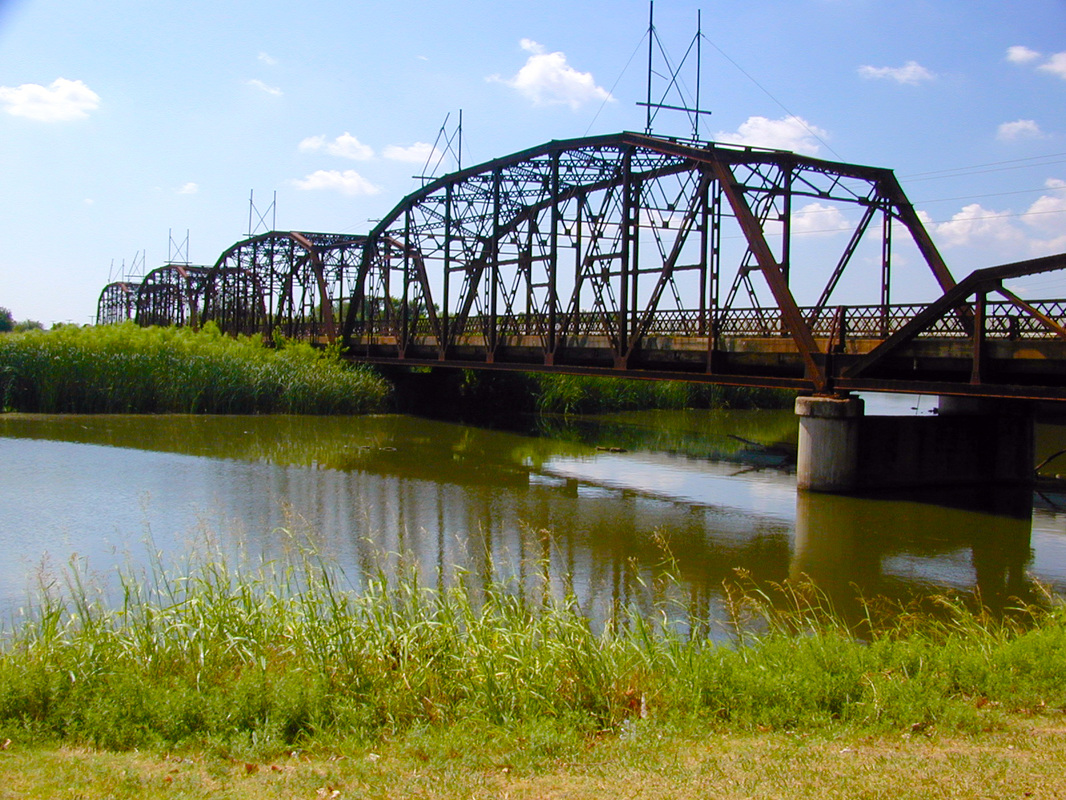
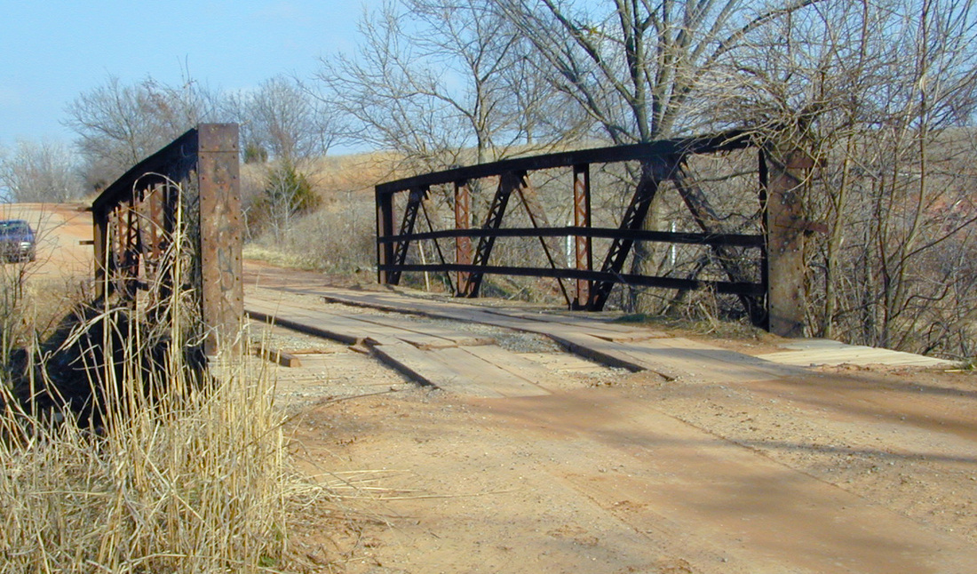
Bridgeport Hill-Hydro Route 66, vicinity Hydro and El Reno (Caddo County and Canadian County) Oklahoma. Listed on the National Register of Historic Places March 3, 2004. (This stretch of highway is about 17 miles long, the longest National Register property in Oklahoma, at least as of the time it was accepted.) Photo shows Alfalfa Bill Murray Bridge in that segment.
Bristow Firestone Service Station, Bristow (Creek County), Oklahoma. Listed on the National Register of Historic Places September, 2007.
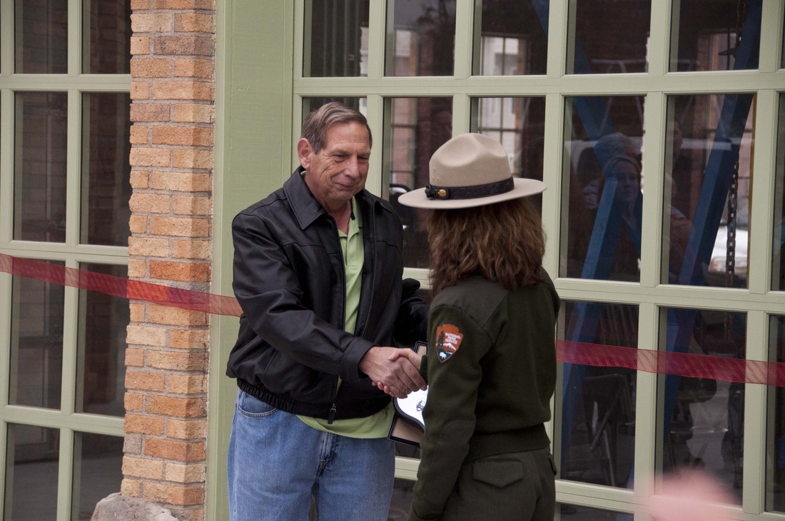
This is the same Firestone Station in Bristow upon its rededication after being significantly rehabilitated by new owner Jack Longacre, here being congratulated by National Park Service Route 66 Corridor Preservation Program Director Ms. Kaisa Barthuli in 2011.
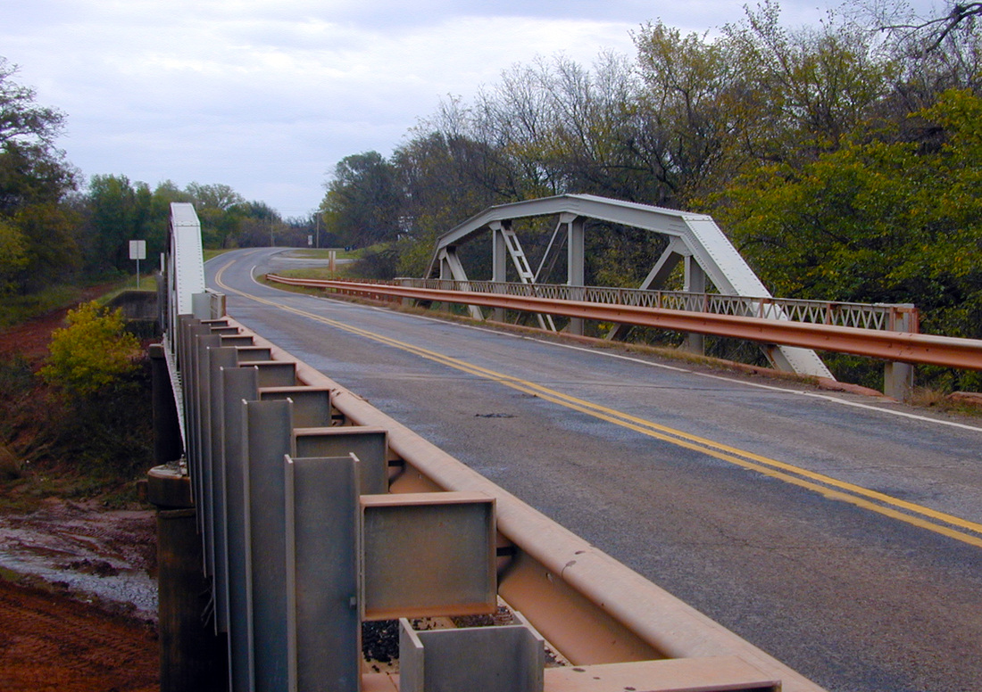
Captain Creek Bridge, Wellston (Lincoln County), Oklahoma. Listed on the National Register of Historic Places March 4, 2004.
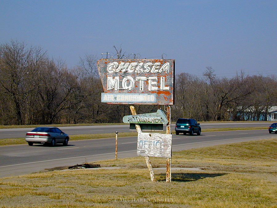
Chelsea Motel, Chelsea (Rogers County), Oklahoma. Listed on the National Register of Historic Places May 27, 2004.
Jackson Conoco Service Station, El Reno (Canadian County), Oklahoma. Listed on the National Register of Historic Places March 2, 2004.
Lake Overholser Bridge, Oklahoma City (Oklahoma County), Oklahoma. Listed on the National Register of Historic Places March 2, 2004.
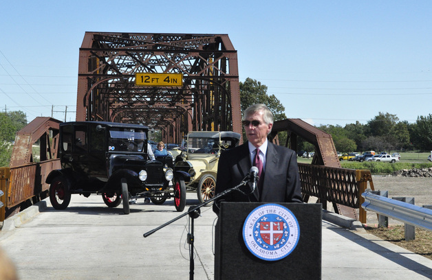
After being listed on the National Register of Historic Places, the Lake Overholser Bridge on Route 66 received careful treatment to strengthen it and restore it to highway traffic while maintaining its historic integrity in 2011.
Little Deep Fork Creek Bridge, vicinity Bristow (Creek County), Oklahoma. Listed on the National Register of Historic Places December 5, 2003.
McDougal Filling Station, vicinity Vinita (Craig County), Oklahoma. Listed on the National Register of Historic Places May 27, 2004.
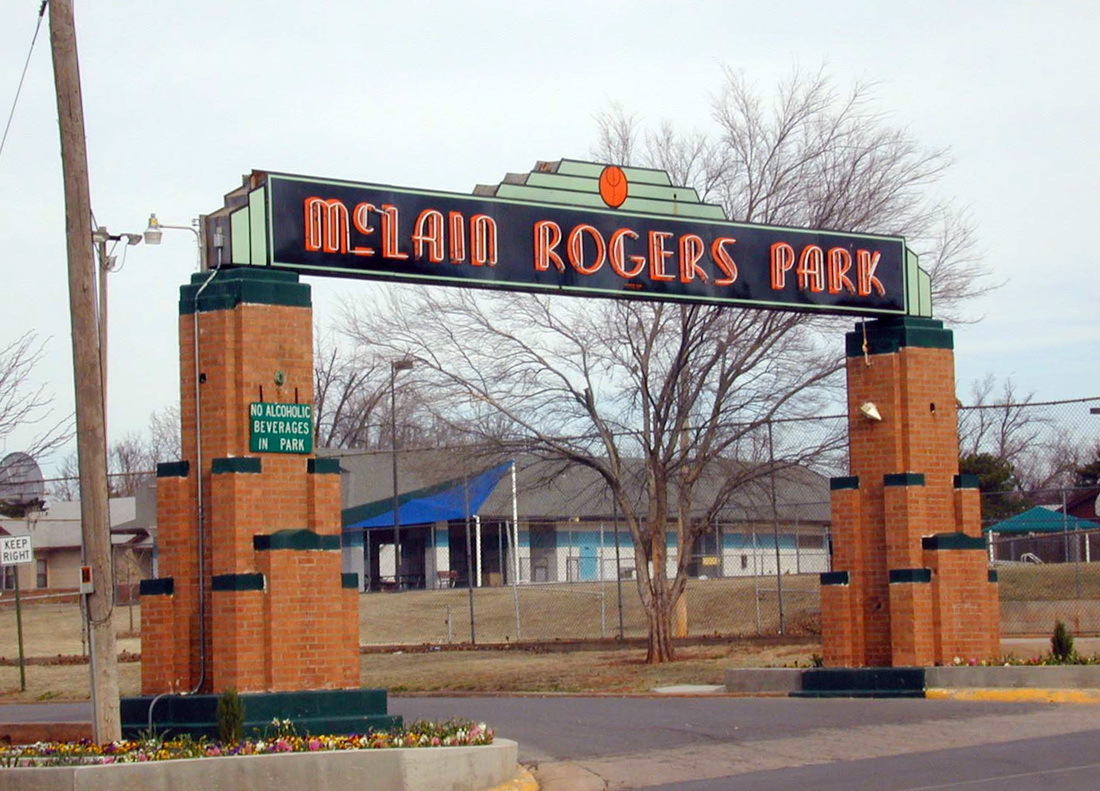
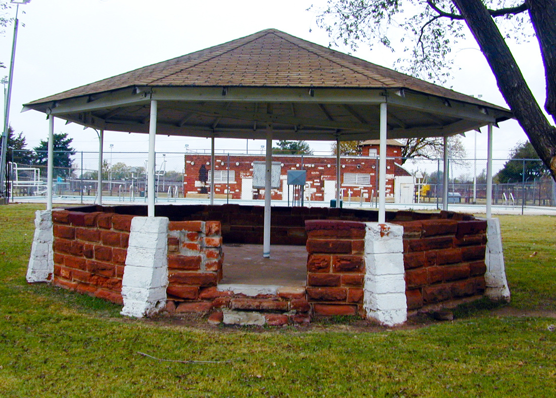
McLain Rogers Park, Clinton (Custer County), Oklahoma. Listed on the National Register of Historic Places September 3, 2004.
Narcissa D-X Gas Station, Narcissa (Ottawa County), Oklahoma. Listed on the National Register of Historic Places December 5, 2003.
Ozark Trails Section of Route 66, vicinity Davenport and Stroud (Lincoln County), Oklahoma. Listed on the National Register of Historic Places December 5, 2003.
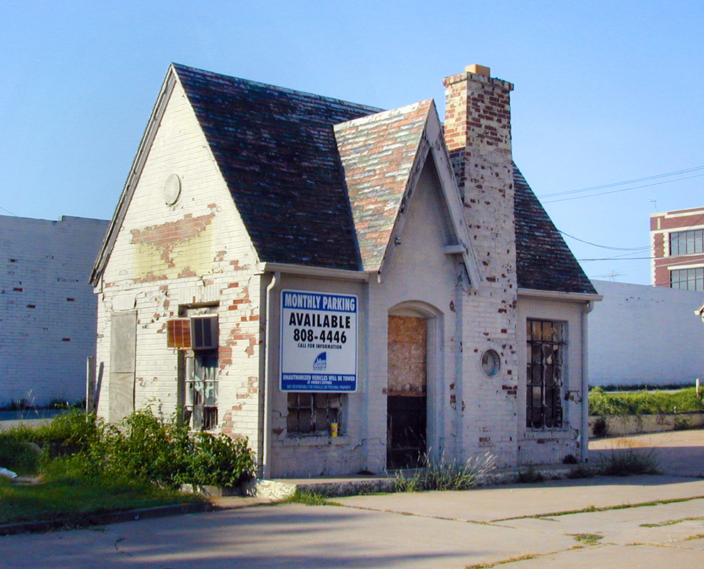
Vickery Phillips 66 Station, Tulsa (Tulsa County), Oklahoma. Listed on the National Register of Historic Places March 3, 2004.
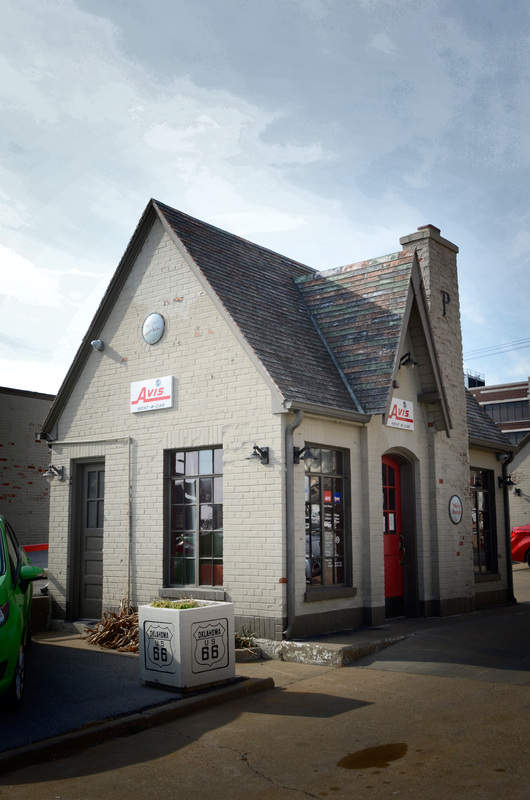
After being listed on the National Register, the Vickery Phillips 66 Station was restored and put into active use with a different, but still automobile related, purpose.
Riviera Courts-Holiday Motel, Miami (Ottawa County), Oklahoma. Listed on the National Register of Historic Places May 27, 2004.
Sayre Champlin Service Station, Sayre (Beckham County), Oklahoma. Listed on the National Register of Historic Places March 3, 2004.
Sayre City Park, Sayre (Beckham County), Oklahoma. Listed on the National Register of Historic Places March 3, 2004.
Phillips 66 Station #473, Tulsa (Tulsa County), Oklahoma. Listed on the National Register of Historic Places December 6, 2004.
West Sapulpa Route 66 Roadbed, vicinity Sapulpa (Creek County), Oklahoma. Listed on the National Register of Historic Places March 3, 2004.
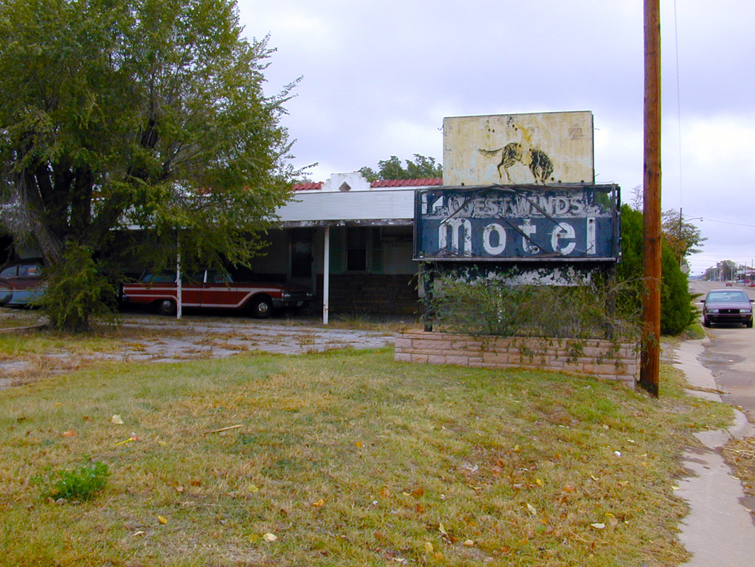
West Winds Motel, Erick (Beckham County), Oklahoma. Listed on the National Register of Historic Places May 27, 2004.
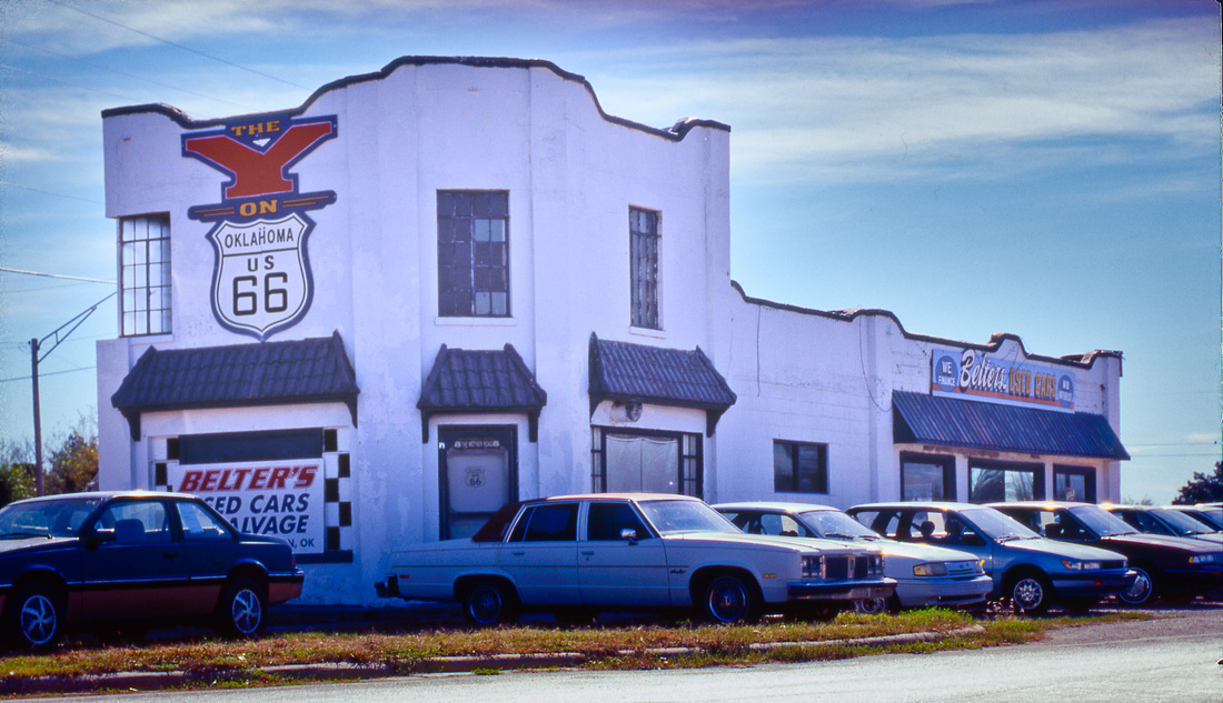
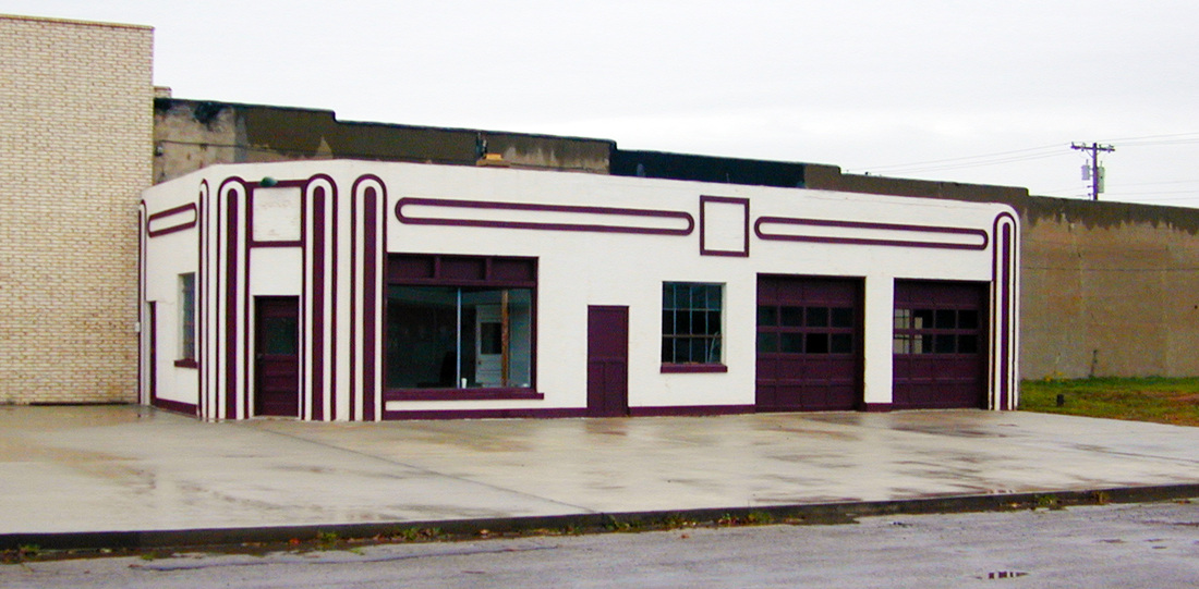
Y Service Station & Café, Clinton (Custer County), Oklahoma. Listed on the National Register of Historic Places May 27, 2004.
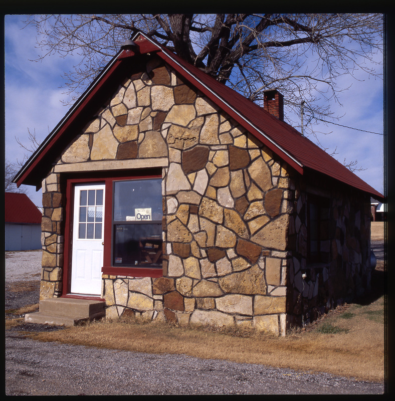
Sites and Sights on Route 66 in Oklahoma--
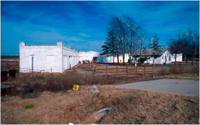
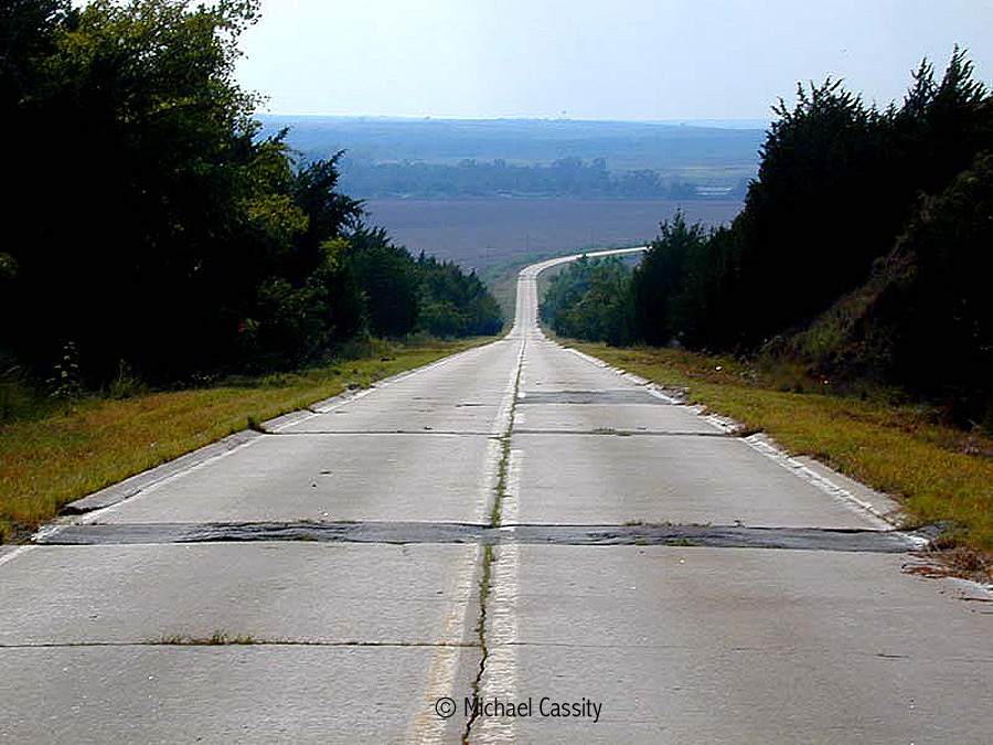
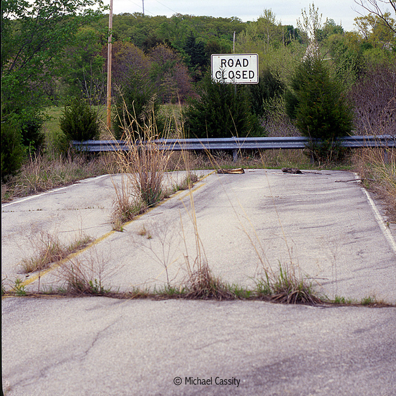
--- A few remnants of Highway 66
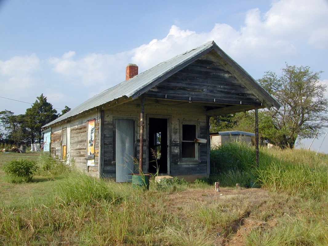
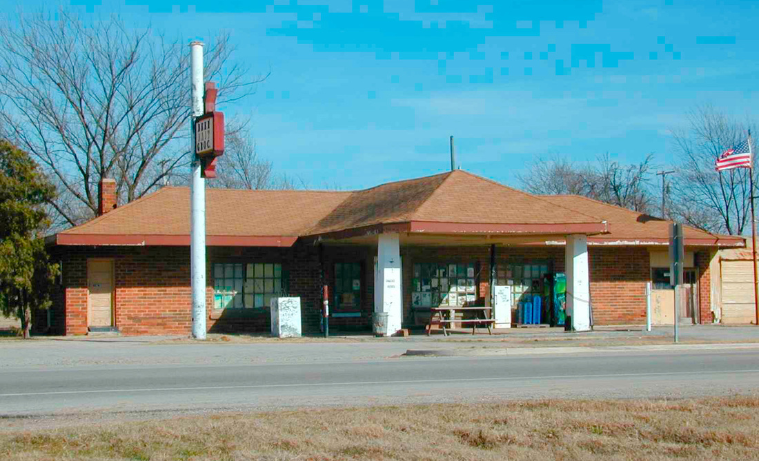
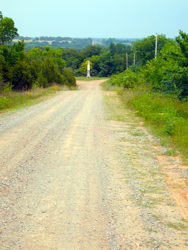
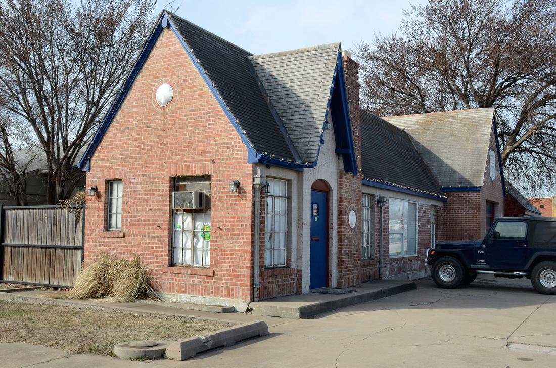
Abandoned cafe, U.S. 66, western Oklahoma.
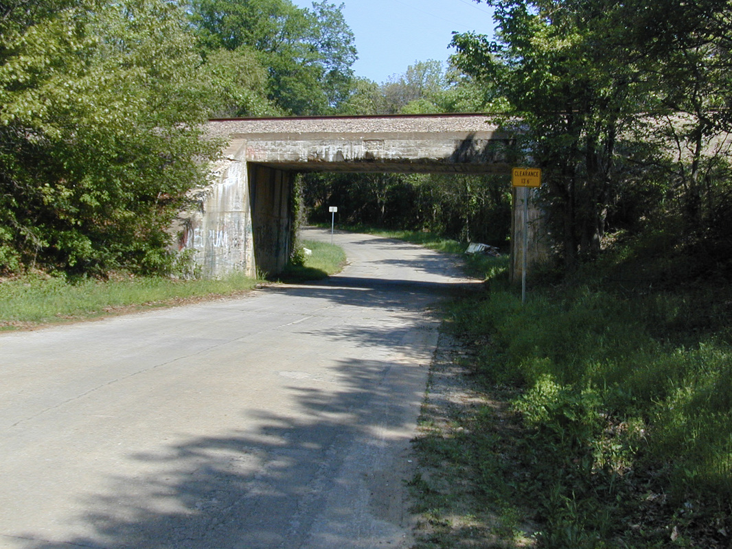
U.S. 66, Bridgeport Hill, west of El Reno, Oklahoma.
Want to travel Route 66 in Oklahoma?
The Oklahoma State Historic Preservation Office has announced a tour map and guide to sites in Oklahoma on U.S. Route 66. Be sure to follow the road and check these notable sites on and along the highway. But you'd better be fast. They are disappearing at an alarming rate.
The following is the SHPO announcement and a list of sites. I added about twenty-five of these sites to the National Register of Historic Places and encourage everyone to investigate them for their history, placing them into the context of the historic transformation of society, economy, and landscape by this highway.
And talk to the good people in the SHPO about Highway 66, about historic preservation, and about what you can do in your own neighborhood.
To access the tour as you drive the historic highway or as you relax at home, just call 405/415-0626, listen to the brief introduction and instructions, and enter the stop numbers (1-72) using your telephone keypad. You then hear or read the text captioned name, location, and brief narrative for each stop. To move to another stop, enter the number when prompted at the end of a stop narrative. The list of stops is provided below and in a brochure available at museums and other locations along the tour route or from the SHPO. Also, the list and map of the stops are found at www.okhistory.org/route66mobiletour. If you are using a smart phone, you can link to more about each stop in particular and about Historic Route 66 in general. The tour is made available through the services of OnCell Systems, Inc.
For more information about the SHPO and its programs, visit http://www.okhistory.org/shpo or call 405/521-6249.
List of Tour Stops
(From east to west)
Stop #1. Coleman Theater, 103 North Main, Miami
Stop #2. Miami Downtown Historic District, roughly bounded by 100 block of North Main, and the zero blocks of South Main, Central Avenue, & Southeast "A" Street, Miami
Stop #3. Miami Marathon Oil Company Service Station, 331 South Main, Miami
Stop #4. Riviera Courts-Holiday Motel, 1 mile west of Main on US 69A, Miami vicinity
Stop #5. Miami Original Nine-Foot Section of Route 66 Roadbed, from Junction of "E" Southwest & 130th to Highway 66, Miami vicinity, (Ends, Stop #6)
Stop #6. Miami Original Nine-Foot Section of Route 66 Roadbed, from Junction of "E" Southwest & 130th to Highway 66, Miami vicinity, (Begins, Stop #5)
Stop #7. Former location, Narcissa D-X Gas Station, 15050 South State Highway 69, Miami vicinity (Demolished after listing in the National Register of Historic Places)
Stop #8. Horse Creek Bridge, Junction of Highway 66 & Horse Creek, Afton vicinity
Stop #9. Former location, Cities Service Station, Junction of First & Central Avenue, Afton (Demolished after listing in the National Register of Historic Places)
Stop #10. McDougal Filling Station, 443956 East State Highway 60 (3 miles east of Vinita)
Stop #11. Little Cabin Creek Bridge, carries US 60/69 over Little Cabin Creek, one and one-half miles southeast of Vinita and approximately one mile southeast of Interstate 44 [Will Rogers Turnpike]
Stop #12. Hotel Vinita, 106 West Canadian, Vinita
Stop #13. Randall Tire Company, 237 South Wilson, Vinita
Stop #14. Former location, Spraker Service Station, 240 South Wilson, Vinita (Demolished after listing in the National Register of Historic Places)
Stop #15. Pryor Creek Bridge, carries First Street over Pryor Creek, Southwest of Junction with State Highway 66, Chelsea vicinity
Stop #16. Chelsea Motel, Northeast corner of First Street & State Highway 66, Chelsea
Stop #17. Ed Galloway’s Totem Pole Park, State Highway 28A, 3.5 miles east of Highway 66, Foyil vicinity
Stop #18. Will Rogers Hotel, 524 West Will Rogers Boulevard, Claremore
Stop #19. Former location, Claremore Auto Dealership, 625 West Will Rogers Boulevard, Claremore (Demolished after listing in the National Register of Historic Places)
Stop #20. Sinclair Service Station, 3501 East Eleventh, Tulsa
Stop #21. Casa Loma Hotel, 2626-2648 East Eleventh, Tulsa
Stop #22. Whittier Square Historic District, roughly between Lewis Avenue, Zunis Avenue, East First, & Interstate 244, Tulsa
Stop #23. Phillips 66 Station #473, 2224 East Admiral Boulevard, Tulsa
Stop #24. Blue Dome Historic District, roughly between South Kenosha Avenue & South Detroit Avenue, Frisco Railroad Tracks & East 8th, Tulsa
Stop #25. Vickery Phillips 66 Station, 602 South Elgin, Tulsa
Stop #26. Eleventh Street Arkansas River Bridge, Highway 66 over the Arkansas River, Tulsa
Stop #27. Cities Service Station #8, 1648 Southwest Boulevard, Tulsa
Stop #28. Former location, 66 Motel, 3660 Southwest Boulevard, Tulsa (Demolished after listing in the National Register of Historic Places)
Stop #29. Stop #29, Sapulpa Downtown Historic District, roughly bounded by Hobson Avenue, Elm, Lee Avenue, & Main, Sapulpa
Stop #30. West Sapulpa Route 66 Roadbed, Junction of Ozark Trail & State Highway 66 .25 miles west of Sahoma Lake Road, Sapulpa vicinity (Ends, Stop #32)
Stop #31. Bridge No. 18 at Rock Creek, Junction State Highway 66 and Rock Creek, Sapulpa vicinity
Stop #32. West Sapulpa Route 66 Roadbed, Junction of Ozark Trail & State Highway 66, .25 miles West of Sahoma Lake Road, Sapulpa vicinity (Begins, Stop #30)
Stop #33. Tank Farm Loop Route 66 Roadbed, Junction of State Highway 66 & Old Highway 66, .6 mile west of Interstate 44 Overpass, Bristow vicinity (Ends, Stop #34)
Stop #34. Tank Farm Loop Route 66 Roadbed, Junction of State Highway 66 & Old Highway 66, .6 mile west of Interstate 44 Overpass, Bristow vicinity (Begins, Stop #33)
Stop #35. Bristow Motor Company Building, 500 North Main, Bristow
Stop #36. Bristow Firestone Service Station, 321 North Main, Bristow
Stop #37. Beard Motor Company, 210 East 9th, Bristow
Stop #38. Bristow Tire Shop, 115 West 4th, Bristow
Stop #39. Texaco Service Station, 201 West 4th, Bristow
Stop #40. Little Deep Fork Creek Bridge, .33 mile east of Junction of County Roads #E0830 & #N3700, Bristow vicinity
Stop #41. Rock Cafe, 114 West Main, Stroud
Stop #42. Hotel Lincoln, 323 Main, Stroud
Stop #43. Ozark Trail Section of Route 66, Junction of County Road #E0890 & the St. Louis & San Francisco Railroad Tracks, Stroud vicinity (Ends, Stop #44)
Stop #44. Ozark Trail Section of Route 66, Junction of County Road #E0890 & the St. Louis & San Francisco Railroad Tracks, Stroud vicinity (Begins, Stop #43)
Stop #45. Chandler Armory, Junction of Mickey Clarkson Avenue & 1st, Chandler
Stop #46. Phillips 66 Station #1423, 701 Manvel Avenue, Chandler
Stop #47. Crane Motor Company Building, 722 Manvel Avenue, Chandler
Stop #48. St. Cloud Hotel, 1216 Manvel Avenue, Chandler
Stop #49. Seaba's Filling Station, 8 miles west of Chandler on Route 66, Chandler vicinity
Stop #50. Captain Creek Bridge, 100 yards west of Junction of Hickory & State Highway 66B, Wellston vicinity
Stop #51. Threatt Filling Station, southwest corner, Junction of Highway 66 & Pottawatomie Road, Luther vicinity
Stop #52. Arcadia Route 66 Roadbed, Extends south/southeast from Junction of State Highway 66 & Hiwassee Road, Arcadia vicinity (Ends, Stop #53)
Stop #53. Arcadia Route 66 Roadbed, Extends south/southeast from Junction of State Highway 66 & Hiwassee Road, Arcadia vicinity (Begins, Stop #52)
Stop #54. Arcadia Round Barn, 11250 E. Highway 66, Arcadia
Stop #55. Citizens State Bank, also known as The Gold Dome, 1112 Northwest 23rd Street, Oklahoma City
Stop #56. Lake Overholser Bridge, .5 mile west of North Council Road on North Overholser Drive, Oklahoma City
Stop #57. Jackson Conoco Service Station, 301 South Choctaw (also known as 121 West Wade), El Reno
Stop #58. Avant’s Cities Service Station, 220 South Choctaw, El Reno
Stop #59. Bridgeport Hill – Hydro, Route 66 Segment, State Highway 66 from Hydro east to US-281 Spur, Bridgeport vicinity, ends at Stop #61
Stop #60. Bridgeport Hill Service Station, Junction of Old Route 66 & US-281 Spur, Geary vicinity
Stop #61. Bridgeport Hill – Hydro, Route 66 Segment, State Highway 66 from Hydro east to US-281 Spur, Bridgeport vicinity, begins at Stop #59
Stop #62. Provine Service Station (also known as Lucille’s), .5 mile east of Junction of Interstate-40 & State Highway 58, Hydro vicinity
Stop #63. Oklahoma Route 66 Museum, 2229 Gary Boulevard, Clinton
Stop #64. Y Service Station & Cafe, 1733 Neptune Drive, Clinton
Stop #65. Canute Service Station, southwest corner of Main and Route 66, Canute
Stop #66. Casa Grande Hotel, 103 East 3rd, Elk City
Stop #67. National Route 66 Museum, 2717 West 3rd Street, Elk City
Stop #68. Sayre Downtown Historic District, Main & 4th, Sayre
Stop #69. Sayre Champlin Service Station, 5th and Main, Sayre
Stop #70. Sayre City Park, 200 yards south of Junction of County Roads #E1200 & #N1870, Sayre
Stop #71. West Winds Motel, 623 Roger Miller, Erick
Stop #72. Magnolia Service Station, southwest corner of the Junction of Elm Street & US-66, Texola
